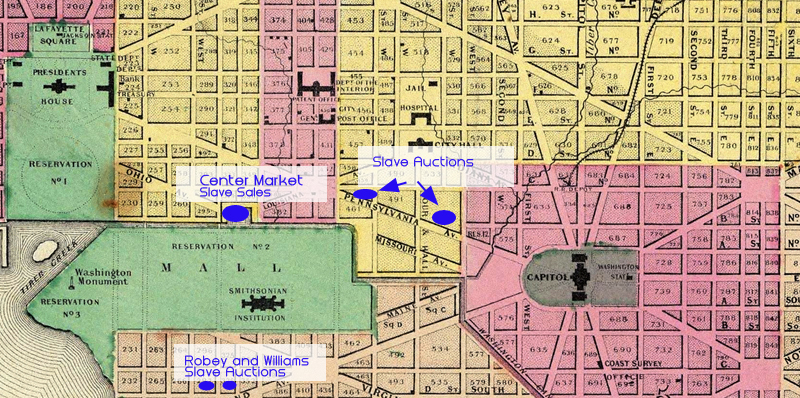
Colton Atlas, 1855, showing former sites of slave trade bordering the National Mall
Item
-
Title
-
Colton Atlas, 1855, showing former sites of slave trade bordering the National Mall
-
Creator
-
G. W. Colton
-
Description
-
Slave trading establishments in Washington, DC are superimposed on this 1855 Atlas of Washington, DC to show the locations of a few of the many slave trading establishments in the city. Businesses flourished on the Mall's borders including slave traders who operated from hotels, auction houses, and taverns until the trade was abolished in the District of Columbia in 1850. South of the Mall, the Yellow House and Robey's were notoriously cruel slave pens. North of the Mall, sales at auction houses flourished, promoted in local newspaper advertisements.
-
Publisher
-
New York: J.H. Colton
-
Extent
-
800 x 398 px..
-
Source
-
David Rumsey Map Collection. View original.
-
Coverage
-
1830-1859
-
Original Format
-
jpg. map.