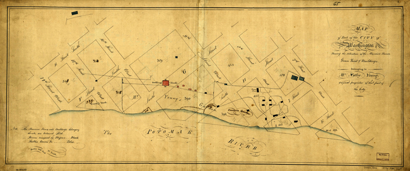
Map of Notley Young's Plantation
Item
-
Title
-
Map of Notley Young's Plantation
-
Creator
-
Nicholas King
-
Date
-
1796
-
Description
-
Notley Young's plantation bordering the Potomac was among the lands appropriated for the city of Washington and its public buildings. These site plans show the plantation's original grounds, buildings, slave quarters, overseer's house, gardens, water features, fence lines, and graveyards. Notley Young conveyed eight squares of land from his property for the federal city. The south side of the Mall, in part, incorporates tracts from the Notley Young plantation.
-
Extent
-
Original: 33 X 84 Cm.
-
Source
-
Library of Congress Geography and Map Division. View original.
-
Coverage
-
Pre-1800s
-
Original Format
-
jpg