Sketch of Washington in Embryo
Item
-
Title
-
Sketch of Washington in Embryo
-
Date
-
1874 (drawn)
-
1792 (depicts)
-
Description
-
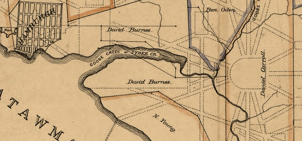
Three-quarters of a century of a century after the founding of the city of Washington, Dr. Joseph Toner, an amateur historian of the District of Columbia, decided to find out who had owned the land of the nation's capital before the city was established. He created a map which showed the boundary lines of property holdings, labeled with the name of the landholder. This portion of Toner's map shows the boundaries on the land that became the National Mall, with plots owned by David Burns, Daniel Carroll, Notley Young, and Ben Oden. The map was drawn in 1874 but depicts the area circa 1792.
-
Source
-
Library of Congress Geography and Map Division. View original.
-
Coverage
-
Pre-1800s