Captain John Smith's Map of Virginia (excerpt)
Item
-
Title
-
Captain John Smith's Map of Virginia (excerpt)
-
Creator
-
Captain John Smith
-
Date
-
1624
-
Description
-
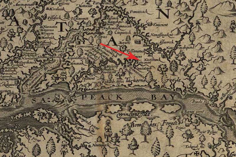
In 1607, English colonists established the Jamestown settlement in Virginia at the mouth of the Chesapeake Bay. Captain John Smith and a small party of colonists explored and mapped the Chesapeake Bay, its rivers, and the surrounding lands. The map is oriented with north to the right, not the top. They recorded the names of more than 200 Native American villages and tribes, including the settlement of the Nacotchtank, Algonquians whose village served as a major trading center on the Anacostia River near the site of the US Capitol and the National Mall.
-
Source
-
Library of Congress Geography and Map Division. View original.
-
Coverage
-
Pre-1800s
-
Original Format
-
map